

About Us
WHERE DRONE INNOVATION MEETS QUALITY

Drones have become essential tools across various industries, such as agriculture, construction, mining, safety inspections, and surveillance. They offer advantages like time and cost savings, operational flexibility, and enhanced safety. Tukutech is dedicated to enhancing efficiency in Tanzanian industries by integrating drone technologies and robotics into their daily practices.
TukuTech is committed to delivering cutting-edge drone solutions to a wide range of industries, including mining, engineering, agriculture, and research. The quality of our work comes from dedicated and talented young locals and international partnerships, which involve collaboration in using advanced drone tools and data processing technologies, enabling us to stay at the forefront of drone technology and cutting-edge survey methods..
With a sharp focus on delivering precise data and maintaining high standards of quality, we offer efficient and cost-effective services customized to not only meet but also exceed our customers' expectations.
Why Choosing Us
Benefits of our Drone-Based Survey
Faster Exploration Process
Safe for Workers
Flexible Field Operation
Cost Efficient
Better Data Quality
Less Environmental Invasion
Our Partners


Our Services
Our primary focus is on mining and agriculture, where we employ drone technologies from Finland as well as China. alongside an experienced, tech- workforce. Our services encompass crop spraying, crop health assessment, geophysical surveys, and topographic survey. By leveraging these innovations, Tukutech streamlines farming operations ensures farmer well-being, and optimizes mining activities, offering precise data collection and cost-effective solutions.
- All
- Mining
- Agriculture
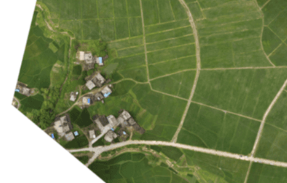
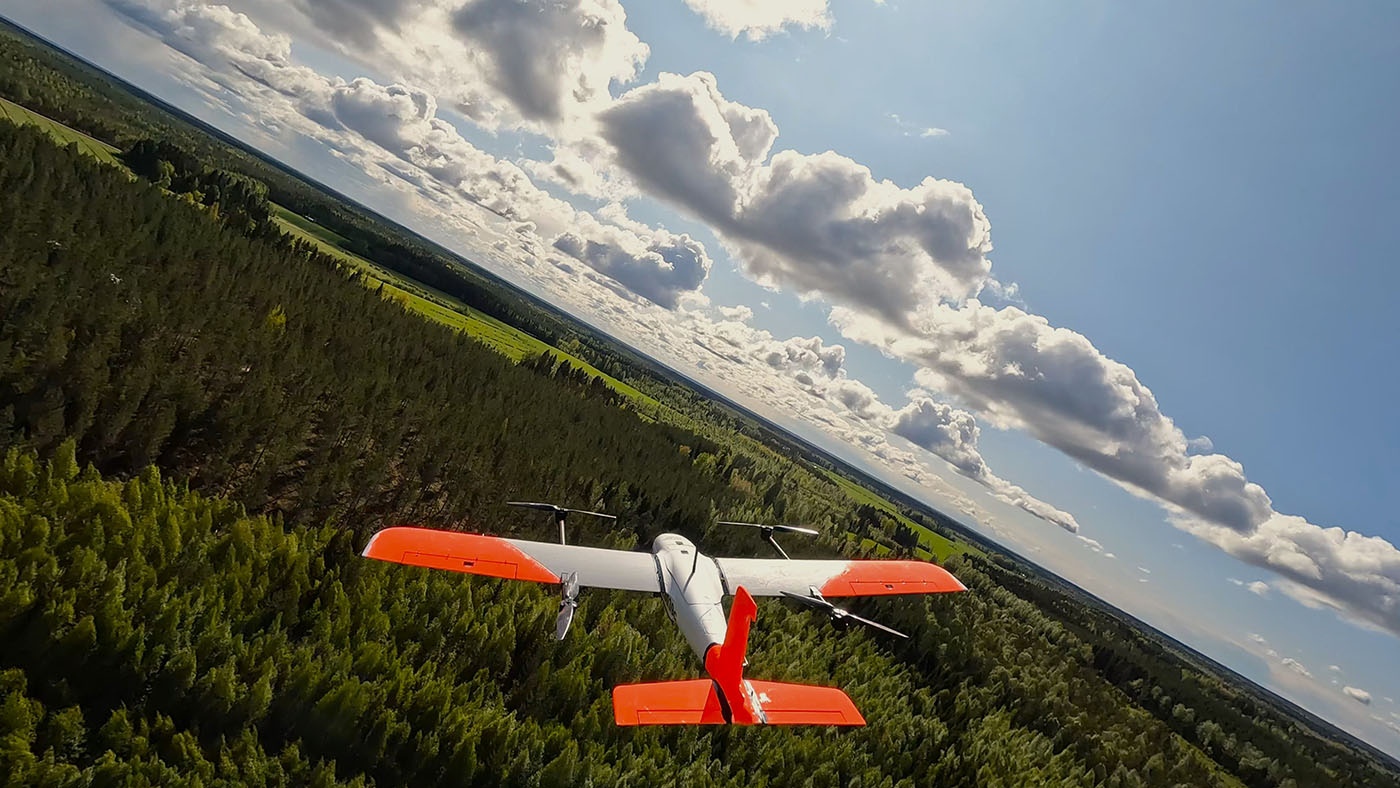
RGB MAPPING
RGB Mapping (Landscape Height Maps, Enhanced Visibility Land Features, Accurate measurements i.e; Volume and Area)....
SPREADING SEEDS AND FERTILIZERS
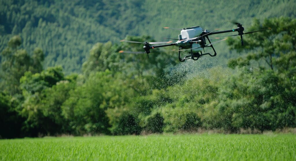
We utilize AGRASS T40 to efficiently spread seeds and fertilizer across different agricultural landscapes. With the cap...
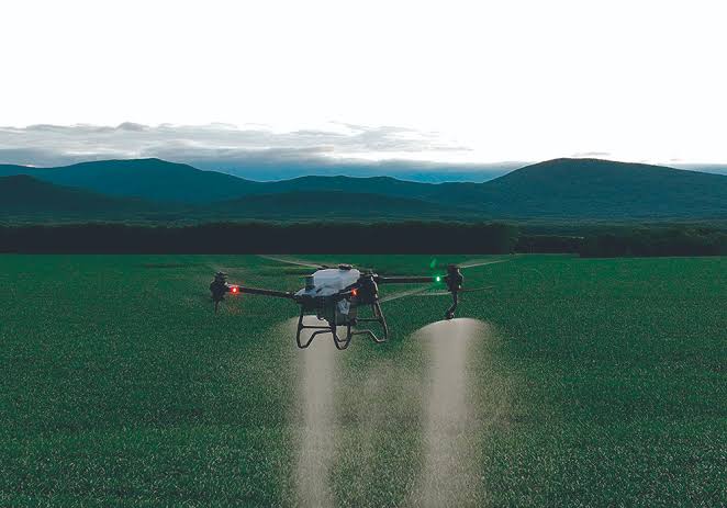
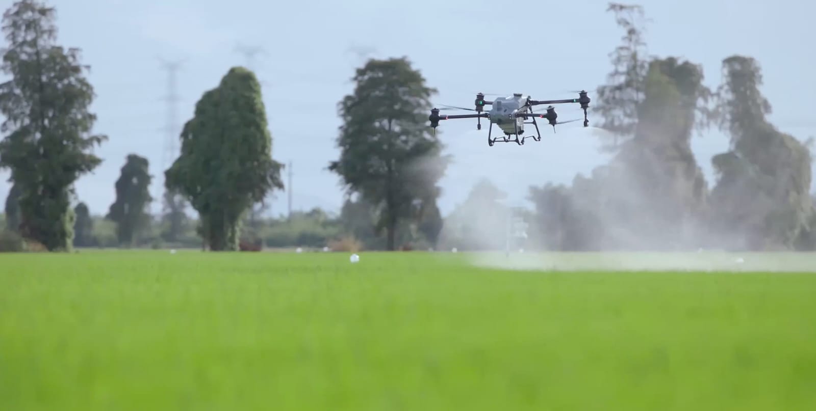
SPRAYING PESTICIDES
Our AGRASS T40 drone excels in precise pesticide application, ensuring optimal coverage while minimizing environmental i...

GEOPHYSICAL SURVEY
A magnetic survey can map out changes in the amount of magnetic minerals as well as associated rock types. Thus, a magne...
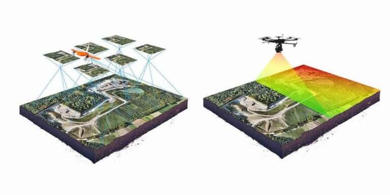
TOPOGRAPHIC SURVEYS
A topographic survey locates all surface features of a property, and depicts all natural features and elevations. In ess...
SPRAYING FERTILIZERS
Utilizing our AGRASS T40 drone, we deliver targeted fertilizer applications tailored to the specific needs of each crop....
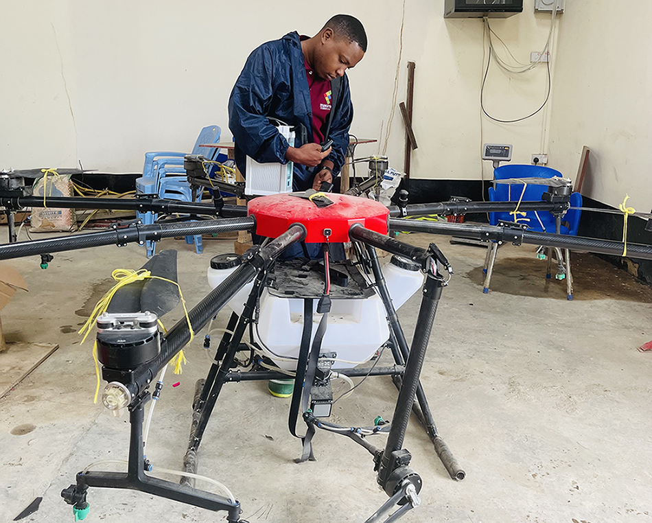
DRONE REPURPOSING & REPAIR SERVICES
TukuTech has a team of experts who possess the expertise to effectively repair drones from a wide range of brands and mo...
Our Fleet
Over 2 hrs Flight time
Simultaneous use of 2-3 drones
1000 line kms capacity in a single day
Ability to follow various terrain
Both rural and urban missions
Our Blog Posts
Contact
Location:
Dar es Salaam, Tanzania
Email:
tukudronetech@gmail.com
Call:
+255 629 961 155